Leica RTC360 Product Specifications
General | |
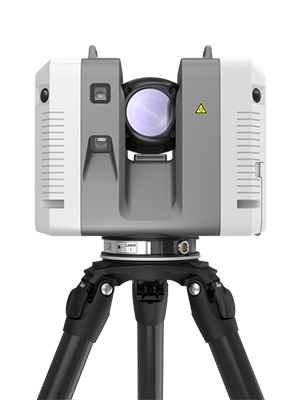
| 3D laser scanner | High-speed 3D laser scanner with integrated HDR spherical imaging system and Visual Inertial System (VIS) for real time registration |
Performance | |
| Data acquisition | < 2 mins for complete full dome scan and spherical HDR image at 6mm @ 10 m resolution |
| Real time registration | Automatic point cloud alignment based on real time tracking of scanner movement between setups based on Visual Inertial System (VIS) by video-enhanced inertial measurement unit |
| Double scan | Automatic removal of moving objects |
| Check & Adjust | Field procedure for targetless checking of angular parameters |
Scanning | |
| Distance measurement | High-speed, high dynamic time of flight enhanced by Waveform Digitising (WFD) technology |
| Laser class | 1 (in accordance with IEC 60825-1:2014), 1550 nm (invisible) |
| Field of view | 360° (horizontal) / 300° (vertical) |
| Range | Min. 0.5 - up to 130 m |
| Speed | Up to 2,000,000 pts / sec |
| Resolution | 3 user selectable settings (3/6/12 mm @ 10 m) |
| Accuracy* |
Angular accuracy 18" Range accuracy 1.0 mm + 10 ppm 3D point accuracy 1.9 mm @ 10 m 2.9 mm @ 20 m 5.3 mm @ 40 m |
| Range noise* ** | 0.4 mm @ 10 m, 0.5 mm @ 20 m |
Imaging | |
| Camera | 36 MP 3-camera system captures 432 MPx raw data for calibrated 360° x 300° spherical image |
| Speed | 1 minute for full spherical HDR image at any light condition |
| HDR | Automatic, 5 brackets |
Navigation Sensors | |
| Visual Inertial System | Video enhanced inertial measuring system to track movement of the scanner position relative to the previous setup in real time |
| Tilt | IMU based, Accuracy: 18" (for upright and upside down setups with +/- 10° inclination) |
| Additional sensors | Altimeter, Compass, GNSS |
Operation | |
| On scanner | Touch-screen control with finger touch, full colour WVGA graphic display 480 x 800 pixels |
| Mobile devices |
Leica Cyclone FIELD 360 app for iOS and Android tablet computers and smartphones including: - Remote control of scan functions - 2D & 3D data viewing - Tagging - Automatic alignment of scans |
| Wireless | Integrated wireless LAN (802.11 b/g/n) |
| Data storage | Leica MS256, 256 GB exchangeable USB 3.0 flash drive |
Design & Physical | |
| Housing | Aluminium frame and sidecovers |
| Dimensions | 120 mm x 240 mm x 230 mm / 4.7" x 9.4" x 9.1" |
| Weight | 5.35 kg / 11.7 lbs, nominal (without batteries) |
| Mounting mechanism | Quick mounting on 5/8" stub on lightweight tripod / optional tribrach adapter / survey tribrach adapter available |
Power | |
| Internal battery |
2 x Leica GEB364 internal, rechargeable Li-Ion batteries. Duration: Typically up to 4 hours Weight: 340 g per battery |
| External | Leica GEV282 AC adapter |
Environmental | |
| Operating temperature | -5° to +40°C |
| Storage temperature | -40° to +70°C |
| Operating low temperatures**** | -10° to +40°C |
| Dust/Humidity*** | Solid particle/liquid ingress protection IP54 (IEC 60529) |
All specifications are subject to change without notice.
All accuracy specifications are on a level of confidence of 68% according to the Guide
of the Expression of Uncertainty in Measurement (JCGM100:2008) unless otherwise
noted.
* At 89% albedo.
** For single shot measurements
*** For upright and upside down setups with a +/- 15° inclination
**** Extended low temperature operation is possible to -10°C if internal temperature
is at or above -5°C when powered on. For extended low temperature measurement, it
is recommended that QA procedures are followed.
Scanner: Laser class 1 in accordance with IEC60825:2014
iPhone and iPad are trademarks of Apple Inc.
Android is a trademark of Google.