Design smarter, more efficient infrastructure with the Esri ArcGIS AEC Collections
What is a Collection?
A pre-packaged configuration of ArcGIS products tailored specifically for AEC firms. Includes ArcGIS Online with apps and capabilities to create, manage, visualize and share project data.
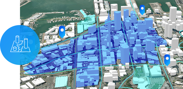
Location + Design
Leverage geospatial data in your Autodesk products to:
- Increase design efficiency.
- Add context to your design.
- Access authoritative GIS content.
What’s included:
- 1 Creator
- 1 ArcGIS Online GIS Pro Basic
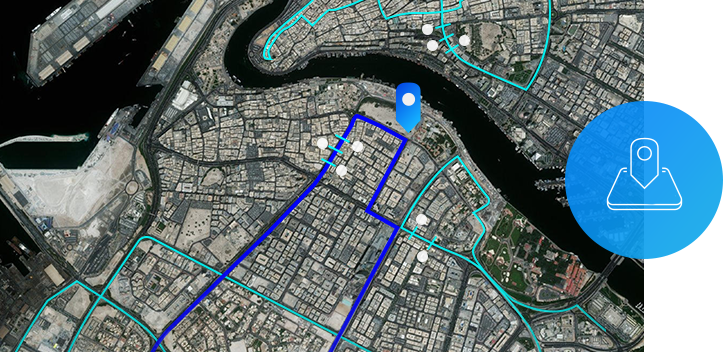
Field Operations
Improve project coordination and operational efficiency by:
- Easily accessing GIS data collected from the field.
- Modernizing field data collection.
- Gaining greater visibility into field operations.
What’s included:
- 1 Creator
- 3 Field Workers
- 1 ArcGIS Online GIS Pro Basic
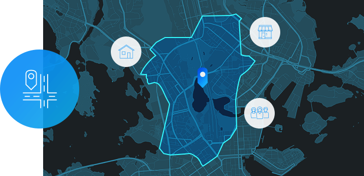
Site Selection
Simplify your design process by:
- Assessing project site viability.
- Validating design decisions.
- Helping your clients make better-informed decisions.
What’s included:
- 1 ArcGIS Business Analyst Web App Online
- 1 Creator
- 1 ArcGIS Online GIS Pro Basic

Collaboration
Deliver projects more efficiently by:
- Sharing project information with clients.
- Streamlining project reviews.
- Reducing project overhead expenses.
What’s included:
- 1 Project Delivery ArcGIS Online
- 1 Creator
- 1 ArcGIS Online GIS Pro Basic
Package Details
Creator
- Create maps and apps
- Access authoritative data to accelerate your work and expand analysis
- Analyze data to understand trends
- Share maps with stakeholders in a variety of ready-to-use apps
- Plus the benefits of the
- Field Worker user type
Site Selection
- Increase customer satisfaction by engaging your customers in your projects
- Project Delivery allows you to collaborate and share information directly with your customers
- From status updates to reviews and edits, this unlocks a new way to deliver project work
Field Worker
- Use apps for data collection, surveys and inspections
- Seamlessly integrate field-collected data
- Share updates with your team in real time
ArcGIS Online GIS Professional Basic
- Create maps and apps
- Analyze data to understand trends
- Share maps with your team or the public
- Collaborate with team members
- Administer users and content within the subscription
- Use content from ArcGIS Living Atlas of the World
- Plus the benefits of Creator and Field Worker user types
ArcGIS Business Analyst Web App Online
- Provides location-based intelligence for planning, site selection and customer segmentation
- Combine demographic, lifestyle and spending data with map-based analytics for accurate reports and dynamic presentations
Connect it with the Autodesk AEC Collection
ArcGIS paired with the Autodesk AEC Collection helps you collect and analyze data from the field, improve communication with key stakeholders and puts your projects into geographic context to help understand impacts to the environment.
Get in touch
Let our team know if you would like to learn more about our solutions.
Give us a shout – we’re here to help!
Get in touch
Let our team know if you would like to learn more about our solutions.
Give us a shout – we’re here to help!